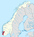
Vaizdas:Rogaland in Norway 2020.svg

Rinkmenos SVG peržiūros PNG dydisː 544 × 600 taškų. Kitos 6 rezoliucijos: 218 × 240 taškų | 435 × 480 taškų | 696 × 768 taškų | 928 × 1 024 taškų | 1 857 × 2 048 taškų | 1 361 × 1 501 taškų.
Didesnės raiškos iliustracija (SVG rinkmena, formaliai 1 361 × 1 501 taškų, rinkmenos dydis: 1,58 MiB)
Rinkmenos istorija
Paspauskite ant datos/laiko, kad pamatytumėte rinkmeną tokią, kokia ji buvo tuo metu.
| Data/Laikas | Miniatiūra | Matmenys | Naudotojas | Paaiškinimas | |
|---|---|---|---|---|---|
| dabartinis | 16:09, 26 lapkričio 2020 |  | 1 361 × 1 501 (1,58 MiB) | VulpesVulpes42 | Border correction (Tjeldsund). |
| 23:40, 22 birželio 2019 |  | 1 361 × 1 501 (1,58 MiB) | NordNordWest | corr | |
| 00:00, 1 gegužės 2019 |  | 1 361 × 1 501 (1,58 MiB) | NordNordWest | corr | |
| 20:07, 22 balandžio 2019 |  | 1 361 × 1 501 (1,57 MiB) | NordNordWest | corr | |
| 22:13, 21 balandžio 2019 |  | 1 361 × 1 501 (1,57 MiB) | NordNordWest | == {{int:filedesc}} == {{Information |description= {{de|Lage der Provinz Rogaland in Norwegen, Stand: 1. Januar 2020}} {{en|Location of county Rogaland in Norway (2020)}} |source={{Own}} |date={{Date|2019|04|20}} |author={{U|NordNordWest}} |permission= |other_versions={{SVG locator maps (location map scheme)}} }} {{Kartenwerkstatt}} == {{int:license-header}} == {{User:NordNordWest/LicenceMap}} Category:SVG locator maps of counties in Norway (location map scheme) [[Category:Files by Nord... |
Paveikslėlio naudojimas
Paveikslėlis yra naudojamas šiuose puslapiuose:
Visuotinis rinkmenos naudojimas
Ši rinkmena naudojama šiose viki svetainėse:
- Naudojama cs.wikipedia.org
- Naudojama et.wikipedia.org
- Naudojama fa.wikipedia.org
- Naudojama fi.wikipedia.org
- Naudojama frr.wikipedia.org
- Naudojama fr.wikipedia.org
- Naudojama ja.wikipedia.org
- Naudojama nl.wikipedia.org
- Naudojama simple.wikipedia.org
- Naudojama sv.wikivoyage.org
- Naudojama vls.wikipedia.org


