Vaizdas:Europe1815 1905.jpg
Šios peržiūros dydis: 759 × 600 taškų. Kitos 5 rezoliucijos: 304 × 240 taškų | 607 × 480 taškų | 972 × 768 taškų | 1 280 × 1 012 taškų | 1 503 × 1 188 taškų.
Didesnės raiškos iliustracija (1 503 × 1 188 taškų, rinkmenos dydis: 823 KiB, MIME tipas: image/jpeg)
| Ši byla yra iš bendros Wikimedia Commons nemokamų resursų duomenų bazės, palaikomos Wikimedia Foundation organizacijos. Norėdami sužinoti licencijavimo smulkmenas, žiūrėkite paveikslėlio aprašymą |  |
Į paveikslėlio aprašymą |
Aprašymas
_en.png)
.png)
.jpg)
Licencija
This media file is in the public domain in the United States. This applies to U.S. works where the copyright has expired, often because its first publication occurred prior to January 1, 1929, and if not then due to lack of notice or renewal. See this page for further explanation.
|
 | |
 |
This image might not be in the public domain outside of the United States; this especially applies in the countries and areas that do not apply the rule of the shorter term for US works, such as Canada, Mainland China (not Hong Kong or Macao), Germany, Mexico, and Switzerland. The creator and year of publication are essential information and must be provided. See Wikipedia:Public domain and Wikipedia:Copyrights for more details.
|
Rinkmenos istorija
Paspauskite ant datos/laiko, kad pamatytumėte rinkmeną tokią, kokia ji buvo tuo metu.
| Data/Laikas | Miniatiūra | Matmenys | Naudotojas | Paaiškinimas | |
|---|---|---|---|---|---|
| dabartinis | 15:45, 19 birželio 2021 | | 1 503 × 1 188 (823 KiB) | LeontinaVarlamonva | crop white space |
| 00:22, 25 balandžio 2009 |  | 1 584 × 1 230 (363 KiB) | Alex:D | Whitened | |
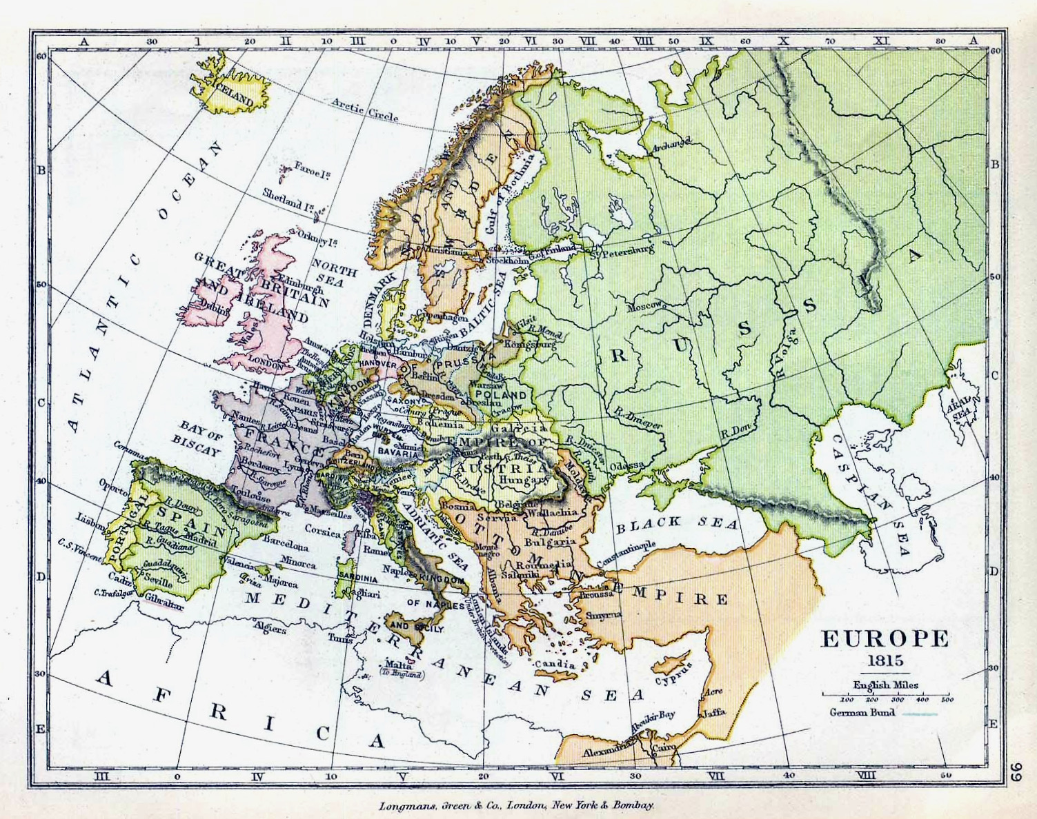
| 15:49, 7 balandžio 2006 |  | 1 584 × 1 230 (293 KiB) | Cave cattum | '''Courtesy of the University of Texas Libraries, The University of Texas at Austin.''' {{Information| |Description = Europe 1815 |Source = The Public Schools Historical Atlas edited by C. Colbeck, published by Longmans, Green, and Co. 1905. |Date = |Au |
Paveikslėlio naudojimas
Paveikslėlis yra naudojamas šiuose puslapiuose:
Visuotinis rinkmenos naudojimas
Ši rinkmena naudojama šiose viki svetainėse:
- Naudojama cs.wikipedia.org
- Naudojama de.wikipedia.org
- Naudojama en.wikipedia.org
- Naudojama fa.wikipedia.org
- Naudojama hy.wikipedia.org
- Naudojama ja.wikipedia.org
- Naudojama ko.wikipedia.org
- Naudojama mt.wikipedia.org
- Naudojama mwl.wikipedia.org
- Naudojama pl.wikipedia.org
- Naudojama pt.wikipedia.org
- Naudojama ro.wikipedia.org
- Naudojama vi.wikipedia.org
- Naudojama zh.wikipedia.org