Vaizdas:Georgia adm location map.svg

Didesnės raiškos iliustracija (SVG rinkmena, formaliai 1 715 × 913 taškų, rinkmenos dydis: 156 KiB)
| Ši byla yra iš bendros Wikimedia Commons nemokamų resursų duomenų bazės, palaikomos Wikimedia Foundation organizacijos. Norėdami sužinoti licencijavimo smulkmenas, žiūrėkite paveikslėlio aprašymą |  |
Į paveikslėlio aprašymą |
Aprašymas
| Aprašymas |
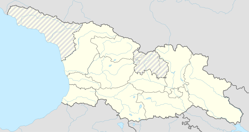
Deutsch: Positionskarte von Georgien
English: Location map of Georgia
|
||||||||||||
| Data | |||||||||||||
| Šaltinis |
Own work using:
|
||||||||||||
| Autorius | NordNordWest | ||||||||||||
| SVG genesis | Šis vektorinis paveikslėlis sukurtas su Adobe Illustrator naudotojo NordNordWest, and with Inkscape.
|
||||||||||||

Licencija
Usage of this file with:

explanatory notes: Legally binding is only the full legalcode. For a free usage I recommend to respect the following licence conditions:
1. Provide my name as given above: NordNordWest,
2. a copy of, or the URI for, the applicable license: https://creativecommons.org/licenses/by-sa/3.0/de/legalcode,
3. the title of the work,
4. in the case of an adaptation, a credit identifying the use of the work in the adaptation.
This license and the rights granted hereunder will terminate automatically upon any breach by you of the terms of this license. Any of the above conditions can be waived if you get permission from the copyright holder. If you have questions or wish differing conditions, please contact me through nnwest or my discussion page ![]() t-online.de
t-online.de
- Jūs galite:
- dalintis – kopijuoti, platinti bei persiųsti šį darbą
- pri(si)taikyti – adaptuoti darbą
- Su šiomis sąlygomis:
- autoriaus nurodymas – Turite pateikti atitinkamą kreditą, pateikti nuorodą į licenciją ir nurodyti, ar buvo atlikti pakeitimai. Tai galite padaryti bet kokiu būdu, bet ne taip, kad licencijos išdavėjas patvirtintų jus ar jūsų naudojimą.
- dalinkis panašiai – Jei perdirbsite, redaguosite ar atkursite šį darbą, jį galėsite platinti tik su tokia pačia ar panašia į šią licencija.

Rinkmenos istorija
Paspauskite ant datos/laiko, kad pamatytumėte rinkmeną tokią, kokia ji buvo tuo metu.
| Data/Laikas | Miniatiūra | Matmenys | Naudotojas | Paaiškinimas | |
|---|---|---|---|---|---|
| dabartinis | 01:03, 16 balandžio 2018 | | 1 715 × 913 (156 KiB) | PlatonPskov | Тбилиси 2008 |
| 00:59, 16 balandžio 2018 |  | 1 715 × 913 (156 KiB) | PlatonPskov | Тбилиси 2008 | |
| 20:18, 26 rugsėjo 2014 |  | 1 715 × 913 (152 KiB) | NordNordWest | == {{int:filedesc}} == {{Information |Description= {{de|1=Positionskarte von Georgien}} {{en|1=Location map of Georgia}} {{Location map series N |stretching=135 |top=43.7 |bottom=40.9 |left=39.8 |right=46.9 }} |Source={{Own using}} * United States Nati... |
Paveikslėlio naudojimas
Paveikslėlis yra naudojamas šiuose puslapiuose:
- Abastumanis
- Abaša
- Achalcichė
- Achalkalakis
- Achmeta
- Algečio nacionalinis parkas
- Ambrolauris
- Anaklija
- Bacario rezervatas
- Bagdatis
- Bakurianis
- Batetis
- Batumis
- Bolnisis
- Boržomio–Charagaulio nacionalinis parkas
- Boržomis
- Cageris
- Calendžicha
- Calka
- Cchaltubas
- Chašuris
- Chobis
- Chonis
- Cnoris
- Dedoplisckaras
- Diklosmta
- Dmanisis
- Dušetis
- Džangitau
- Džimara
- Džvaris
- Gardabanis
- Gelačio vienuolynas
- Goris
- Gurdžaanis
- Karcachis
- Karelis (Gruzija)
- Kaspis
- Kazbegio nacionalinis parkas
- Kazbekas
- Kintrišio rezervatas
- Kobuletis
- Kolchidės nacionalinis parkas
- Kutaisis
- Kvarelis
- Lagodechis
- Lančchutis
- Likanis
- Lisio ežeras
- Madatapa
- Marneulis
- Martvilis
- Mccheta
- Mestija
- Ninocminda
- Onis
- Ozurgetis
- Paleostomis
- Paravanis
- Potis
- Rustavis
- Sagamas
- Sagaredžas
- Samtredija
- Sačcherė
- Senakis
- Signachis
- Stepanacminda
- Tbilisio marios
- Tbilisio nacionalinis parkas
- Tbilisis
- Tebulosmta
- Telavis
- Terdžola
- Tetnuldis
- Tetri Ckaro
- Tkibulis
- Ušguli
- Valė (Gruzija)
- Vanis
- Vašlovanio nacionalinis parkas
- Vėžlių ežeras
- Zestafonis
- Zilgachochas
- Zugdidis
- Čiatura
- Šchara
- Šablonas:City/Gruzijos miestas
- Šablonas:Location map Gruzija
Visuotinis rinkmenos naudojimas
Ši rinkmena naudojama šiose viki svetainėse:
- Naudojama als.wikipedia.org
- Naudojama av.wikipedia.org
- Naudojama az.wikipedia.org
- Naudojama ba.wikipedia.org
- Naudojama crh.wikipedia.org
- Naudojama de.wikipedia.org
- Tiflis
- Oldowan
- Kutaissi
- Batumi
- Rustawi
- Zchinwali
- Poti
- Gori
- Stepanzminda
- Abastumani (Adigeni)
- Sugdidi
- Mzcheta
- Telawi
- Dmanissi
- Bordschomi
- Zqaltubo
- Samtredia
- Achalziche
- Nationalpark Bordschomi-Charagauli
- Flughafen Tiflis
- Tschiatura
- Chaschuri
- Bolnissi
- Bakuriani
- Senaki
- Sestaponi
- Kveda Nassakirali
- Qwareli
- Achalkalaki
- Assureti
- Gudauri
- Lagodechi-Nationalpark
- Wani
- Temur-Stepania-Stadion
- Zalka
- Mestia
- Namochwani
- Vorlage:Positionskarte Georgien
- Sinatle-Stadion
- Dschawa
- Marneuli
- Kobuleti
- Osurgeti
- Vorlage:Positionskarte Georgien Südossetien
Žiūrėti visuotinį šios rinkmenos naudojimą.