Vaizdas:Největší rozmach české moci na rozhraní století XIII. a XIV.jpg
Didesnės raiškos iliustracija (1 472 × 1 467 taškų, rinkmenos dydis: 534 KiB, MIME tipas: image/jpeg)
| Ši byla yra iš bendros Wikimedia Commons nemokamų resursų duomenų bazės, palaikomos Wikimedia Foundation organizacijos. Norėdami sužinoti licencijavimo smulkmenas, žiūrėkite paveikslėlio aprašymą |  |
Į paveikslėlio aprašymą |
Aprašymas
| Aprašymas |
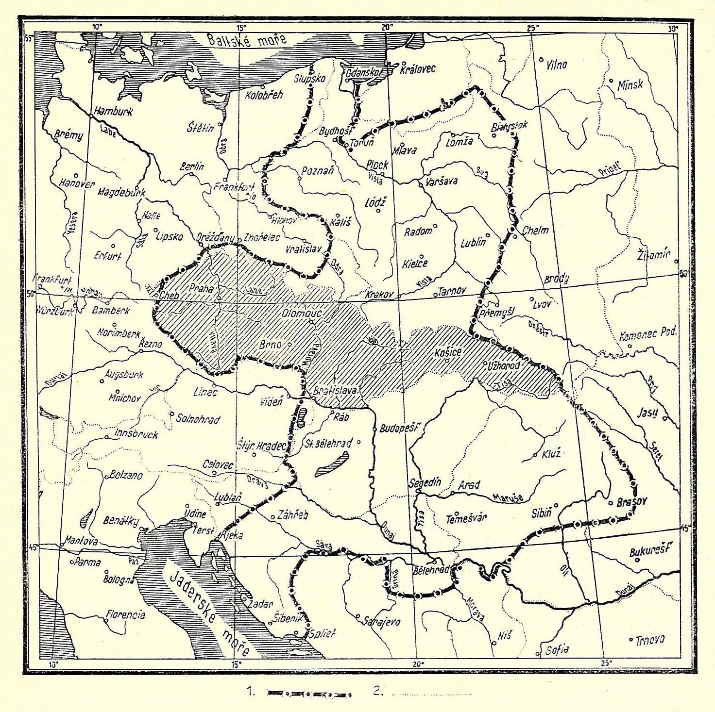
Čeština: Mapa největšího rozmachu moci českých králů na rozhraní 13. a 14. století. (1. hranice říše Přemyslovců, 2. hranice států v době vydání knihy.)
English: Map showing the largest territorial extension of the power of the Bohemian kings at the turn of the 14th century. (1. borders of the empire of the Přemyslids, 2. existing borders of states in 1937.) |
| Data | |
| Šaltinis | František Kurfürst: Válečné dějiny československé, Šolc a Šimáček, Praha, 1937 |
| Autorius | Nežinoma |
Licencija
|
This is a faithful photographic reproduction of a two-dimensional, public domain work of art. The work of art itself is in the public domain for the following reason:
The official position taken by the Wikimedia Foundation is that "faithful reproductions of two-dimensional public domain works of art are public domain". This photographic reproduction is therefore also considered to be in the public domain in the United States. In other jurisdictions, re-use of this content may be restricted; see Reuse of PD-Art photographs for details. {{PD-Art}} template without license parameter: please specify why the underlying work is public domain in both the source country and the United States
(Usage: {{PD-Art|1=|deathyear=''year of author's death''|country=''source country''}}, where parameter #1 can be PD-old-auto, PD-old-auto-expired, PD-old-auto-1996, PD-old-100 or similar. See Commons:Multi-license copyright tags for more information.) | ||||
Rinkmenos istorija
Paspauskite ant datos/laiko, kad pamatytumėte rinkmeną tokią, kokia ji buvo tuo metu.
| Data/Laikas | Miniatiūra | Matmenys | Naudotojas | Paaiškinimas | |
|---|---|---|---|---|---|
| dabartinis | 00:54, 12 spalio 2009 | | 1 472 × 1 467 (534 KiB) | Alfie983 | {{Information |Description={{cs|1=Mapa největšího rozmachu české moci na rozhraní 13. a 14. století. (1. hranice říše Přemyslovců, 2. hranice států v době vydání knihy.)}} {{en|1=Map showing the largest territorial extension of the power |
Paveikslėlio naudojimas
Paveikslėlis yra naudojamas šiuose puslapiuose:
Visuotinis rinkmenos naudojimas
Ši rinkmena naudojama šiose viki svetainėse:
- Naudojama cs.wikipedia.org
- Naudojama de.wikipedia.org
- Naudojama sk.wikipedia.org